
Heavy Rain Triggers Flood Warnings in British Columbia
- Dec 10, 2025
- 2 min read
Update – December 11, 2025:
Highway conditions and flood impacts have escalated since yesterday’s report. All major routes between the Interior and the Lower Mainland are now closed due to flooding, debris, and high avalanche risk. Evacuation orders and alerts are also in place in the Fraser Valley. Full details are available in today’s updated story: https://www.exnews.net/vernon-news/major-highways-to-lower-mainland-shut-down
December 10 2025 - As forecasted, a series of atmospheric rivers has delivered heavy rainfall to southern British Columbia in recent days, causing river levels to rise rapidly.
On December 10, 2025, the BC River Forecast Centre issued upgrades to several flood alerts as the situation intensified.
The River Forecast Centre relies on predictive models and real-time streamflow measurements from gauges across the province. Current conditions show many stations with flows at 1- to 2-year return periods, while forecasts indicate potential peaks reaching 10- to 20-year levels in some areas later on Wednesday or into Thursday.

The Centre’s advisory map uses colours to show the level of concern:
Large parts of the province are shaded yellow, indicating High Streamflow Advisories. This means river levels are rising or expected to rise rapidly, with possible minor flooding in low-lying areas but no major flooding anticipated. These advisories cover regions including Coldwater, Central Coast, South Coast, Vancouver Island, South Interior, and South-East BC.
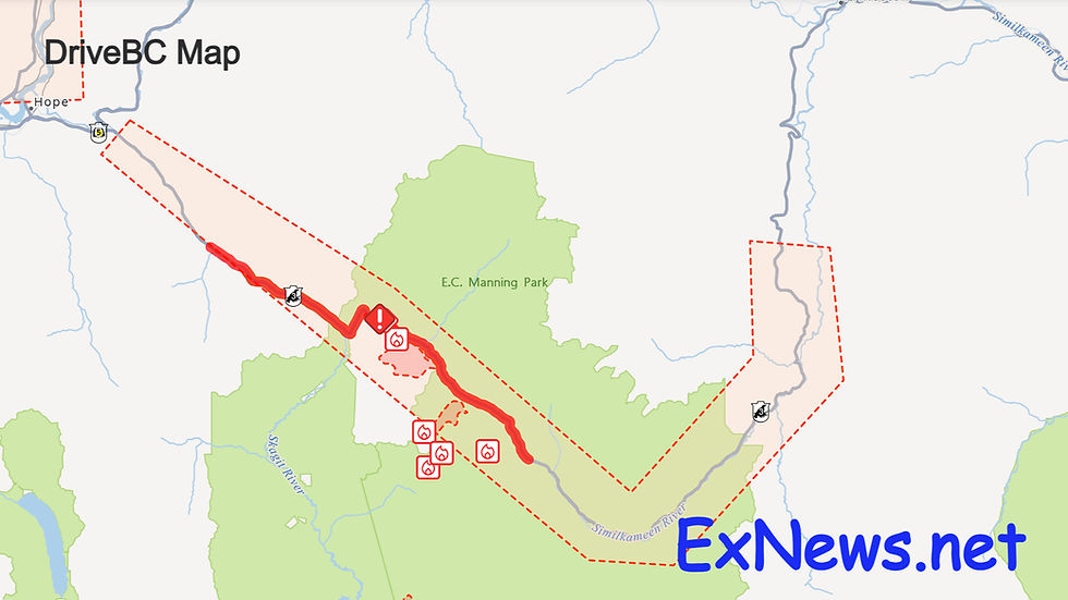
Orange/brown areas represent Flood Watches, where river levels are rising and may exceed bankfull, leading to flooding of adjacent areas. New Flood Watches have been issued for the Ashnola and Similkameen rivers (including tributaries south of Princeton and Keremeos), with an upgrade for the Tulameen River.
A small red area in the Fraser Valley East marks a Flood Warning – the most serious level. This means river levels have exceeded or will soon exceed bankfull, and flooding of nearby lands is expected or occurring. The warning, upgraded at 10:00 AM, applies to the Fraser Valley East including the Sumas River and Chilliwack River, as well as other Lower Fraser tributaries around Abbotsford, Chilliwack, Hope, and east through Manning Park, with potential spillover from the Nooksack River.
Heavy rainfall and rising temperatures, with freezing levels reaching 2500 metres, are melting shallow snowpack and adding to runoff through rain-on-snow conditions.
Rainfall since Monday has totalled 45–100 mm in the Fraser Valley, 30–80 mm on the South Coast, and up to 80–160 mm on West Vancouver Island.
More rain is expected today: 90–130 mm in the Fraser Valley through Manning Park, and 40–70 mm in Metro Vancouver.
These conditions increase risks of unstable river banks, erosion, submerged roads, swift water hazards, flooding, and landslides.
Residents in the Fraser Valley East (including Abbotsford, Chilliwack, and the Sumas area), near the Similkameen, Ashnola, and Tulameen rivers, and in other affected coastal and interior regions are urged to stay clear of river banks, avoid driving through flooded areas, keep storm drains clear of leaves, and review emergency plans.
For preparation information, visit PreparedBC. or Emergency Info at https://www.emergencyinfobc.gov.bc.ca/


Comments